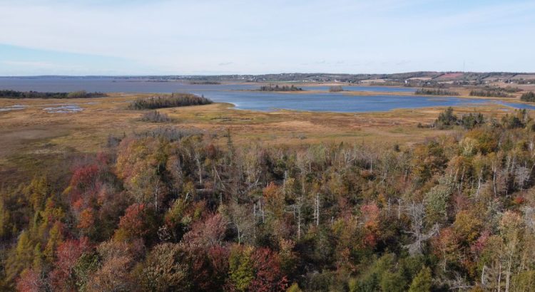
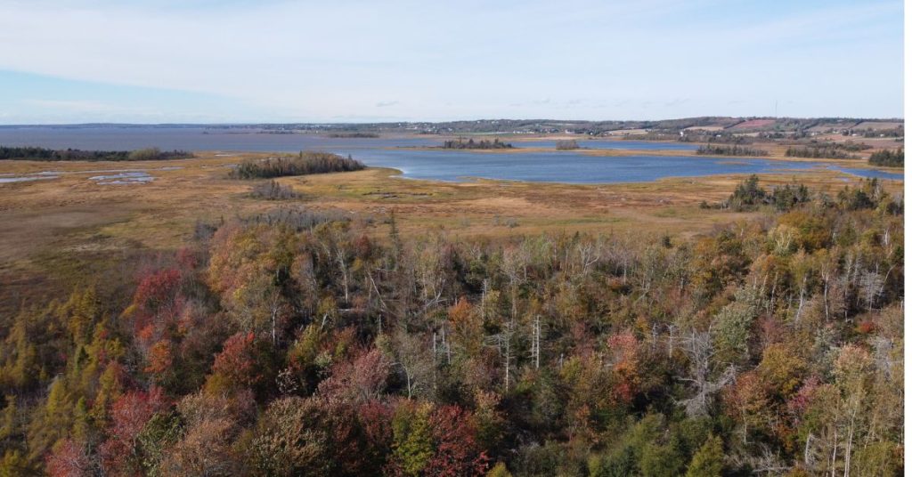
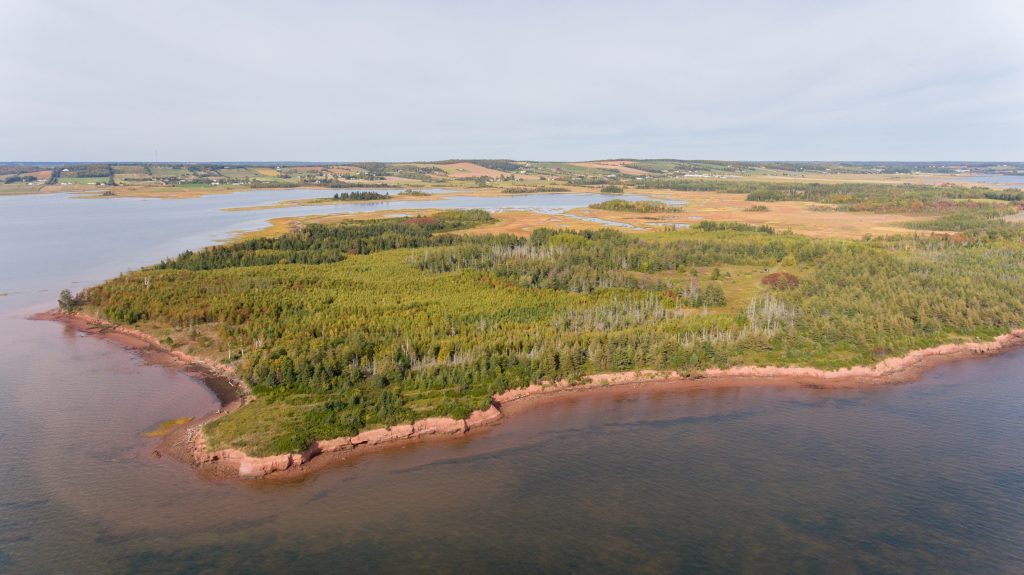
The Judson Salt Marsh Natural Area is 117 acres located on the Crown Point headland in Alexandra, Queens County, Prince Edward Island. This donation adjoins Island Nature Trust’s existing 182-acre Crown Point – Wjikijek Natural Area. The majority of the property is coastal saltmarsh on Jardines Bay, bounded by mixed dominated forest and a three-acre forested island. The Mi’kmaq name for Crown Point is Wji’kijek, meaning “the place where stumps are found.”
Natural Area Map
Acquisition and Legal Status
The Judson Salt Marsh Natural Area was donated by William and Tara Judson and family in October 2023. William Judson’s parents, Donald and Virginia Judson, purchased the land for their family farm in the late 1960s.
“This land has been part of my family’s life for generations, even before my parents purchased it in the 1960s. The Judson family has lived in the area for over 200 years. Stories have been passed down from generation to generation about the marsh and the families that made use of it.”
William Judson
To learn more about this generous donation, click here.
This donation of land was made possible thanks to the Government of Canada’s Ecological Gift Program. This Program provides a way for Canadians with ecologically sensitive land to protect nature and leave a legacy for future generations. Made possible by the terms of the Income Tax Act of Canada and the Quebec Taxation Act, it offers significant tax benefits to landowners who donate land or a partial interest in land to a qualified recipient. Recipients ensure that the land’s biodiversity and environmental heritage are conserved in perpetuity. LEARN MORE
Landscape Context
Crown Point is a relatively undeveloped coastal headland located southeast of Stratford, PEI. The point acts as a coastal barrier protecting the rural communities of Alexandra and Pownal from storm surges, winds, and high spring tides. The salt marsh within the property is a part of a broad band of coastal salt marsh that extends along the Hillsborough Bay from Stratford to Orwell. Converging marshes may lead to the headland becoming an island in the future.
Crown Point has significant cultural history for both the Mi’kmaq and the Acadians. Several independent anecdotal reports point to Mi’kmaq and Acadian burial grounds on the point, as well as Mi’kmaq camps and French battlegrounds. Traditional use for this area includes seal hunting and oyster harvesting. Sand flats just off of Crown Point were known as the Mi’kmaq seal harvesting site Ntoagoagantijg before European settlement.
Ecological Description
Crown Point hosts a variety of ecosystems, including salt marsh, bog, freshwater marsh, krummholz forest, coastal bluffs, and mature forest. The headland acts as a wildlife shelterbelt, providing species habitat that is not found in the nearby developed areas.
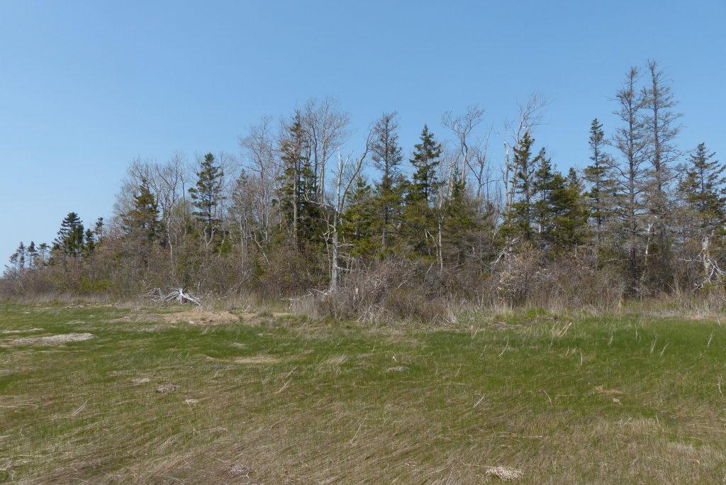
The coastal forest on the Judson Salt Marsh Natural Area consists of mixedwood stands including white spruce (Picea glauca), trembling aspen (Populus tremuloides), white birch (Betula papyrifera), red maple (Acer rubrum), eastern larch (Larix laricina), and American beech (Fagus grandifolia). The 3-acre island within Jardines Bay hosts a similar forest structure, with older hardwoods and more present pit and mound topography. There are additionally sections of alder swamp along the salt marsh, which provides habitat for the federally at-risk Canada warbler (Cardellina canadensis).
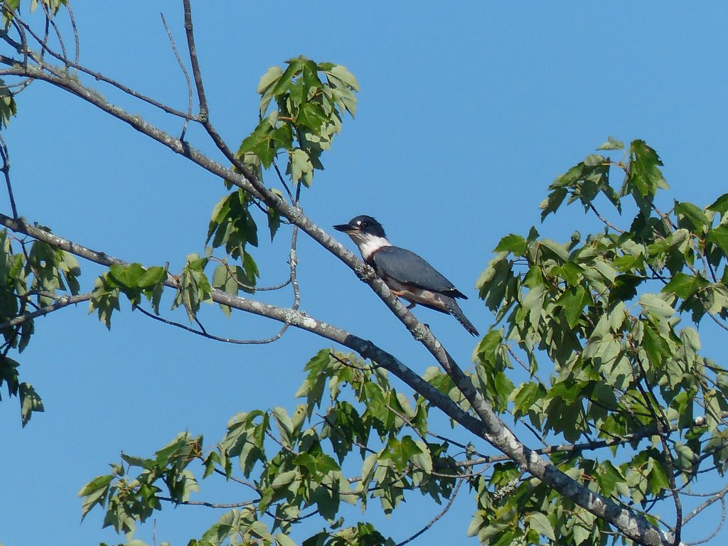
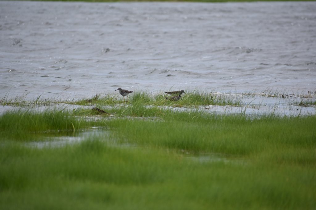
The saltmarsh on this property is extensive and makes up three quarters of the natural area. Salt marshes were historically dyked and farmed on Prince Edward Island, leaving few fully intact. Salt marshes store high amounts of “blue carbon” in their soil and act as carbon sinks. During spring and fall migrations, saltmarshes provide critical stopover locations for Canada geese (Branta canadensis), as well as migratory shorebirds including greater yellowlegs (Tringa melanoleuca), belted-kingfisher (Megaceryle alcyon), and great blue heron (Ardea herodias). Additionally, when they are downstream from agriculture and lawns, salt marshes filter high concentrations of nitrogen from entering ocean water. This is an important local service for the Judson Salt Marsh Natural Area due to a relatively high amount of development and farmland nearby.
Access
The Judson Salt Marsh Natural Area has no trails; those visiting can do so only on foot and should have a good comfort level with navigating using a compass or GPS. The property is accessible via Crown Point Rd. The road is dirt and can be rough in the winter and after rainfall. In the past, the road has flooded after the first curve in Crown Point Road, and it may be best for visitors to park prior to this, at the turn, if water levels are high. The road becomes privately owned at the second curve and has been taken over by a freshwater marsh due to beaver activity. No campfires or overnight camping are allowed on Island Nature Trust Natural Areas.
For more information on access to our natural areas, please contact our Land Stewardship Team.